Thinking about trading daily traffic for a quick train ride instead? If you live in or near 98133, the Shoreline light rail can reshape your routine, from your commute to how you plan errands and evenings out. You want clear, local advice that fits real life. In this guide, you’ll learn how light rail affects daily mobility, housing choices, and neighborhood rhythm across Shoreline and the Seattle–Bellevue–Everett corridor. Let’s dive in.
What light rail means for 98133
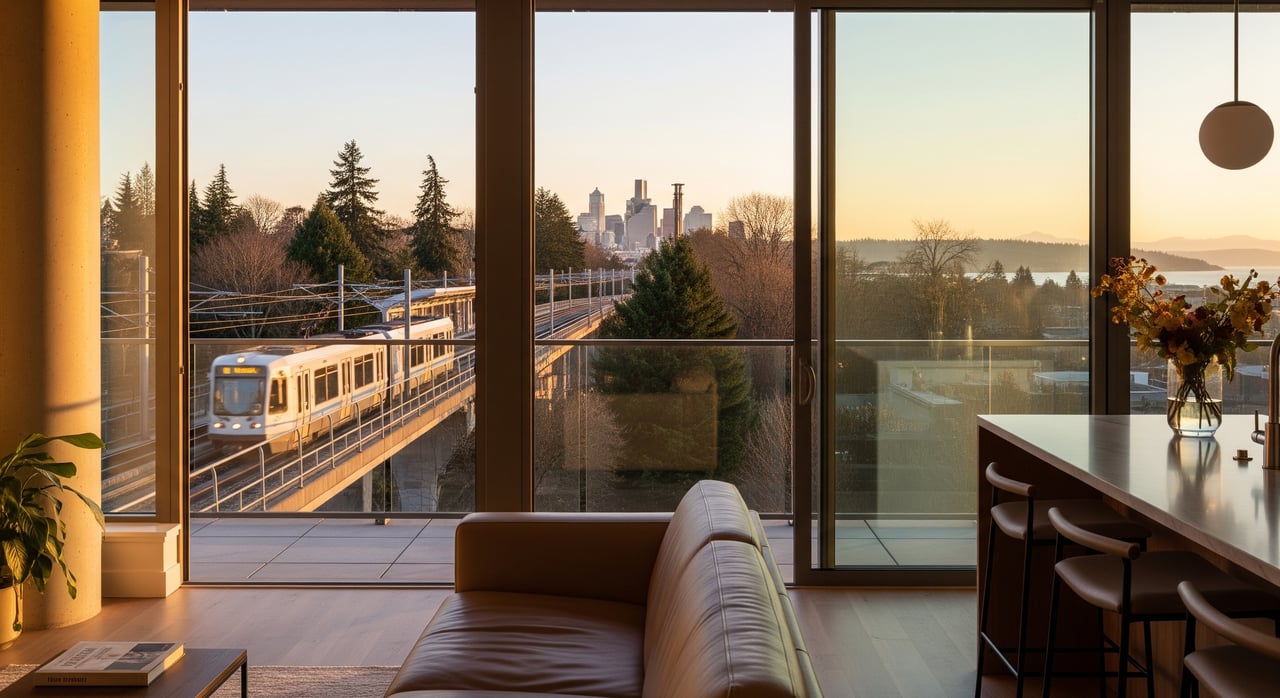
Living near a Shoreline station unlocks reliable access to major destinations along the Link light rail spine. The system is built and operated by regional agencies that coordinate trains, feeder buses, and pedestrian upgrades. For many residents, that translates to fewer car trips and more predictable travel times.
Regional context and agencies
The light rail network is planned and delivered by Sound Transit, with local coordination from the City of Shoreline and King County Metro. These agencies shape station locations, service patterns, sidewalks, bike access, and bus connections. The Puget Sound Regional Council tracks broader commute trends and regional growth, which influence how service ramps up over time.
Station-area planning and timeline
City-led station-area planning typically brings more mixed-use buildings, better walkways, and updated parking rules near stations. You can expect new sidewalks, crosswalks, bike facilities, and ground-floor retail aimed at commuters as projects build out. Project schedules and exact features can evolve, so treat opening dates and amenities as subject to change until agencies confirm them.
Your daily commute
The core benefit of living near light rail is a dependable connection to high-demand destinations. You get a consistent schedule, fewer weather headaches, and the ability to read or work during the ride.
Destinations that benefit most
If you travel to downtown Seattle, the University District, or other hubs along the Link corridor, you will likely see meaningful time savings and less stress. Commuters headed to Bellevue or other Eastside job centers may use a bus or rail transfer. Transit-oriented living tends to work best if you value consistent travel times and easy access to regional centers.
Frequency and peak travel
Link trains generally run more often than local buses during peak and midday periods. That said, exact headways, first and last trains, and event-day surges vary by season and service plan. For daily planning, build in a few minutes of buffer for elevator waits, platform crowding, and transfer walks.
First and last mile tips
Most station-area residents walk 10 to 20 minutes or bike 5 to 10 minutes to the platform. Your route quality matters. Wide arterials like Aurora and freeway ramps can add time if crossings are indirect, so test your path at rush hour. Expect growing micro-mobility options and bike parking demand over time. If you rely on a bike, look for secure storage at or near the station and confirm availability during peak periods.
Parking and drop-off patterns
Some suburban stations include park-and-ride spaces, while others limit parking to encourage walking, biking, and bus transfers. On-street parking rules near stations can change as demand rises. If you plan to drive and park before riding, check local parking management updates and be ready with a backup option if lots fill early.
Bus connections in Shoreline
When light rail service ramps up, bus routes typically shift to feed stations instead of running long one-seat rides. This can shorten your overall trip time even if you add a transfer.
What to expect with re-routing
King County Metro often redesigns nearby lines to link neighborhoods to station hubs. That can mean more frequent short hops to the train and fewer direct buses to distant destinations. If you currently depend on a specific bus, keep an eye out for maps showing future routing and transfer points.
Plan smarter transfers
To make transfers painless, time your front door to platform walk, identify covered waiting areas, and test both morning and evening connections. If you commute with kids or gear, try routes with simple, low-stress crossings and predictable signal timing. A few dry runs will reveal which corners and crosswalks save time.
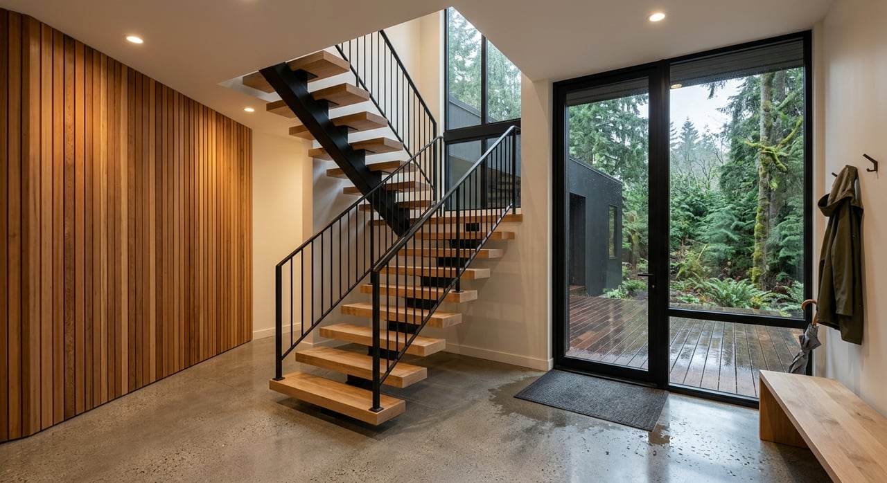
Daily life near the stations
Living close to rail shapes more than your commute. It changes how you plan errands, meet friends, and enjoy weekends without a car.
Parks and outdoor access
Shoreline is known for its green spaces and Puget Sound access. Depending on your exact block, you may bike to neighborhood parks, waterfront viewpoints, and trails within minutes. Weekend routines often include dog walks, short trail runs, or bike rides to playgrounds. Light rail makes it easier for non-drivers to reach these amenities and for you to visit other neighborhoods without a car.
Groceries, dining, and errands
Before major mixed-use projects fully arrive, many station areas feature existing strip retail, cafés, and service businesses along arterials like the Aurora corridor. Over time, new buildings often add commuter-friendly retail such as coffee shops and quick-service food. You may still drive or rideshare for large grocery runs, but expect more daily conveniences to cluster near stations as development progresses.
Schools and community services
School assignments are set by the Shoreline School District and do not change based on proximity to a station. Families typically evaluate programs, commute to activities, and after-school logistics when choosing a home. Community centers and libraries near stations can add daily convenience, so check the location of those services relative to your likely walking route.
Evenings and late trips
Light rail supports travel beyond typical business hours, but exact end times vary by service plan. Suburban station areas can be quieter at night until more housing and retail fill in. If evening travel matters to you, look at the station’s lighting, visibility, and nearby late-night options, then factor those into your routine.
Housing and market impacts
Transit access often changes how people value nearby homes. Understanding these patterns helps you buy or sell with confidence.
Demand and pricing signals
Proximity to rail tends to attract buyers and renters who want reliable, car-light living. That demand can encourage more apartments and townhomes near stations. Over time, higher interest can place upward pressure on prices and rents, though local policies and market cycles shape how that plays out block by block.
Zoning and density changes
Cities commonly rezone areas near stations to allow more housing and mixed-use buildings. In Shoreline, adopted station-area plans guide building heights, multifamily zoning, and commercial overlays. The result is typically more homes near the platform, plus wider sidewalks and safer crossings. If you are investing or developing, verify the current zoning map and any pending updates.
Taxes and ownership costs
Property taxes are set by King County and local levies. Regional infrastructure measures can affect taxes across the area. Not every property is subject to special assessments, so confirm current rates and any local measures relevant to the parcel you are considering.
Construction and daily life
As station areas build out, you may encounter construction traffic, lane shifts, or temporary parking changes. In exchange, longer term improvements usually include better street lighting, upgraded crossings, and new retail. If you work from home, visit during weekday daytime hours to understand construction rhythm and noise.
How to choose the right block
Small differences in location can make a big difference in your experience. Use these on-the-ground checks before you commit.
Walk the route at rush hour
- Time your walk from front door to platform during both morning and evening peak.
- Note sidewalk width, curb ramps, and whether you must cross high-speed traffic.
- Test a rainy-day route for puddles and visibility.
Check bike options and storage
- Identify the safest bike route with the fewest complex intersections.
- Confirm secure bike parking near the station and whether it fills early.
- If you plan to use micro-mobility, look for consistent staging areas.
Gauge noise and vibration
- Spend 10 to 15 minutes near the tracks and main arterials at peak.
- Close windows in a sample unit and listen again to compare interior sound.
- Ask about building insulation or window upgrades if you are sensitive to noise.
Understand parking rules
- Review on-street regulations and any residential parking zones near stations.
- If you need off-street parking, confirm stall count and access hours.
- Have a backup plan for guests during evenings and weekends.
Map daily essentials
- Mark grocery, pharmacy, childcare, and health services within a 10 to 15 minute walk or bike.
- Identify parks and community facilities you expect to use weekly.
- Check bus frequency to your most common off-corridor destinations.
Work with a local guide
Buying or selling near a Shoreline light rail station involves trade-offs that are easier to navigate with neighborhood-level insight. You want clear answers on zoning, first and last mile realities, parking rules, and how bus reconfiguration will affect your door-to-door commute. You also want a plan to maximize value if you are listing, or to position your offer if you are buying in a high-demand pocket.
Seattle Home Guide pairs hyperlocal Shoreline knowledge with full-service brokerage, from single-family and condo representation to land and transit-oriented redevelopment advisory. If you are exploring a move or considering a sale, reach out to Chris Haynes for practical, block-by-block guidance. Get your free home valuation and a tailored plan for living well near light rail.
FAQs
What does living near Shoreline light rail change day to day?
- You get more predictable travel times to destinations along the Link corridor, plus easier access to errands and activities without relying on a car for every trip.
How will bus routes in Shoreline change when light rail service ramps up?
- King County Metro typically reconfigures buses to feed stations, which can shorten total travel time with a transfer while reducing some long one-seat rides.
Will station-area parking be limited for daily riders and residents?
- Some stations include park-and-ride spaces while others limit parking to favor walk, bike, and bus access, and nearby on-street rules can tighten as demand rises.
Are schools affected by proximity to a light rail station in 98133?
- School boundaries are determined by the Shoreline School District, and living near a station does not change assignment; confirm programs and logistics based on your address.
What should I check for a safe and smooth evening commute?
- Review service end times, walk your evening route, note lighting and sightlines, and identify reliable transfer points or pickup zones for late-night rides.
How might light rail influence home values near Shoreline stations?
- Transit access often raises demand and can support more housing types near stations, which may place upward pressure on prices over time depending on policy and market cycles.
What is the best way to compare different blocks near the station?
- Time door-to-platform walks, test crossings at rush hour, listen for peak noise, confirm parking rules, and map essentials like groceries, parks, and childcare.